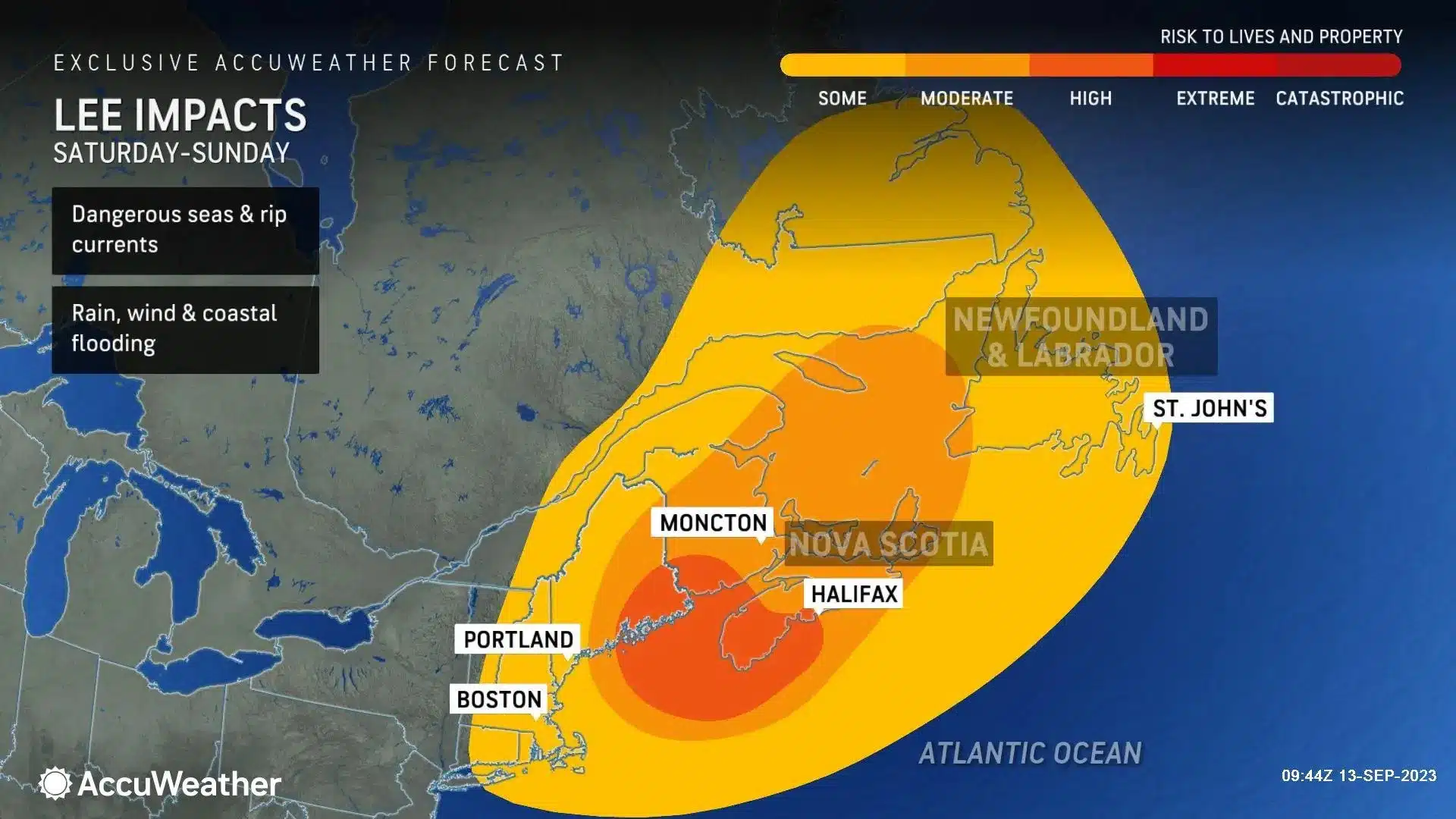
Hurricane Lee will likely reach Atlantic Canada this weekend, possibly as a strong tropical storm or a weak Category 1 hurricane. Experts from the Canadian Hurricane Centre and AccuWeather are increasingly confident about its impact on the Maritimes, even though the exact path remains uncertain.
The storm’s circulation is expected to expand as it moves north, and there’s no current indication of it merging with non-tropical weather systems. Consequently, it could approach the region as either a weak hurricane or a strong tropical storm. The potential track ranges from Maine to southeast Nova Scotia.
Will Hurricane Make Landfall in Atlantic Canada?
Nova Scotia seems most likely to experience landfall, but the storm’s path could shift due to non-tropical weather systems, affecting New England or Newfoundland and Labrador.
Regardless of the landfall location, prepare for heavy rain and high winds, with the severity of flooding and storm surge depending on where and when the storm strikes. Coastal areas east of the landfall are at risk of significant storm surge and property damage, while areas inland may see heavy rainfall leading to stream and river flooding.
“Near and east of where Lee rolls ashore, a significant storm surge will occur, along with the strongest winds and risk of property damage,” AccuWeather forecasts. “The rocky coastline and routine extreme tides in Maine and Canada may minimize storm surge flooding should the storm arrive near the time of high tides. However, if Lee tracks farther west, where the coastline’s slope is more gradual, it could bring significant storm-surge flooding.
Comparing Hurricane Lee to Hurricane Fiona, Lee is expected to have lower sustained winds and smaller wave heights, but residents should remain cautious, given past experiences with tropical systems like Dorian in 2019 and Fiona in 2022. There’s still a chance the storm could shift its path and impact Newfoundland significantly. Stay informed and prepared for any updates or warnings.
“Folks across the region are understandably weary about tropical systems after the impacts of Dorian in 2019 and Fiona in 2022,” the Weather Network said on its website. “It’s likely that Hurricane Lee would not be as strong as either of those two systems if it were to hit the region.” Several sources noted that the storm could still veer further east and do most of its damage in Newfoundland.
Preparing for a Storm
Residents should have enough food and water on hand for 72 hours and secure all gates, lawn furniture, windows, trash cans, hanging plants, and anything that can be picked up by wind.
Some things to consider when preparing for the imminent weather:
- top up all vehicle fuel tanks and park away from trees
- charge cellphones
- keep pets inside
- move boats or other watercraft to high-ground
- refrain from leaving candles unattended in the event of a power outage
- if time allows, do a home inventory checklist, and review your home insurance policy
- clean gutters and downspouts to allow rain to drain and to prevent flooding and freezing around your foundation.
- refill your prescriptions, fill up your gas tank and withdraw a week’s worth of cash so you are prepared in the event of a power outage
About Wedgwood Insurance
Wedgwood Insurance has offices in St. John’s & Corner Brook and is Newfoundland & Labrador’s largest independent insurance broker. We provide straightforward home, auto & business insurance advice.
With over 245 Google My Business reviews, experience the Wedgwood difference with expert advice from our dedicated team. We ensure that every client has the coverage that best suits their needs through upfront complimentary consultations and midterm reviews.
Contact Us
Image courtesy: Accuweather


